File origgenale(842 × 1 837 pixel, dimenzione d'u fail: 541 KB, tipe de MIME: image/jpeg)

Stu file è da Wikimedia Commons e pò essere ausate pe otre pruggette.
'A descriziona sus a pàgene de descrizione d'u file ste aqquà sotte.

Riepileghe

Luogo dello scatto62° 18′ 00″ N, 17° 30′ 00″ E Kartographer map based on OpenStreetMap.Posizione di questa e altre immagini su: OpenStreetMapinfo
Descrizione
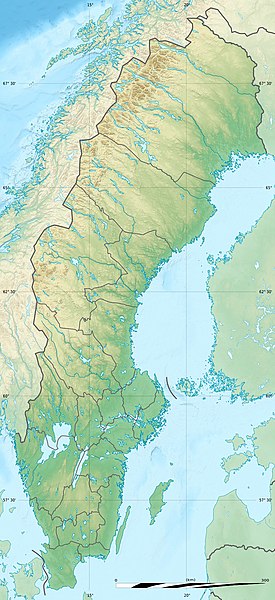
Deutsch: Relief Positionskarte von Schweden
English: Blank relief location map of Sweden
Français : Carte physique vierge de la Suède, destinée à la géolocalisation.

Scale: 1:3,708,000 (precision: 927 m)
Equirectangular projection, WGS84 datum

  • Standard meridian: 017° 30' E
  • Central parallel: 62° 18' N

Geographic limits of the map:

  • Top: 69° 30' N
  • Bottom: 55° 06' N
  • Left: 10° 24' E
  • Right: 24° 36' E
Date
Sorgende

Physical background map, rivers and lakes: own work

Autore Eric Gaba (Sting - fr:Sting) and NordNordWest
Permesse:
(Ause stu file n'otra vote)
Attribution and Share-Alike required
Otre versiune


Kartenwerkstatt
Questa mappa è stata prodotta e/o migliorata nel Kartenwerkstatt, il laboratorio grafico della Wikipedia tedesca, dove è possible proporre mappe da migliorare.

Licenziate da

Ije, 'u titolare d'u copyright de sta fatìe, dichiare de pubblecarle sotte a le seguende licenze:
GNU head Permesse jè garandite pe copià, distribbuì e/o cangià stu documende sotte a le termine d'a Licenze GNU Free Documentation, Versione 1.2 o versione cchiù nuève pubblecate da Free Software Foundation; senze le Seziune Invariande, senze Front-Cover Texts, e senze Back-Cover Texts. 'Na copie d'a licenze jè ingluse jndr'à sezione titolate Licenze GNU Free Documentation.
w:roa-tara:Creatività comune
attribbuzione condivide cose simile
Stu file jè licenziate sotte 'a Creatività comune Attribution-Share Alike 3.0 Unported licenze
Tu si libbere:
  • da spartere – pe copià, distribbuì e trasmettere 'a fatìe
  • da misckà – pe adattà a 'a fatìe
Sotte a le condiziune seguende:
  • attribbuzione – A dà le credite giuste, 'nu collegamende a 'a licenze e dicere ce onne state fatte de le cangiaminde. Puè farle accumme vuè tu, ma none jndr'à 'nu mode ca suggerisce ca 'u licenziande approve a te e l'ause tune.
  • condivide cose simile – Ce tu cange, trasforme o costruisce sus a sta fatìe, tu puè destribbuì 'a fatìe ca ne iesse fore sule sotte a 'a stessa licenze o simile a queste.
Tu puè scacchià 'a licenze ca vuè.

'Ndestaziune

Aggiunge 'na spiegazione sus a 'na linèe de ce rappresende stu file

Eleminde retratte jndr'à stu file

fà 'ndrucà

Agúste 2011

62°18'0.000"N, 17°30'0.000"E

cunde

Cazze sus 'na date/orarie pe vedè 'u fail a cumme asseva jndr'à quidde timbe.

Sciurne/OrarieThumbnailDimenziuneUtendeCommende
corrende01:52, 1 Ott 2017Thumbnail p'a versione de 01:52, 1 Ott 2017842 × 1 837 (541 KB)StingReverted to version as of 17:54, 5 August 2011 (UTC) - Negative: that would be the scale at the extreme top of the map which would introduce a reading error for the lower latitudes
01:29, 1 Ott 2017Thumbnail p'a versione de 01:29, 1 Ott 2017842 × 1 837 (743 KB)SlotaWojAfter adjusting the distance ruler.
19:54, 5 Agú 2011Thumbnail p'a versione de 19:54, 5 Agú 2011842 × 1 837 (541 KB)Sting== {{int:filedesc}} == {{Location|62|18|00|N|17|30|00|E|scale:7000000}} {{Information |Description= {{de|Relief Positionskarte von Schweden}} {{en|Blank relief location map of Sweden}} {{fr|Carte physique vierge de la [[:fr

sta pàgene apponde a stu fail:

Ause d'u file globale

Metadata