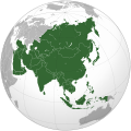
File:Asia (orthographic projection).svg

File origgenale (Fail SVG, nominalmende sonde 541 × 541 pixel, dimenzione d'u fail: 557 KB)
Stu file è da Wikimedia Commons e pò essere ausate pe otre pruggette.
'A descriziona sus a pàgene de descrizione d'u file ste aqquà sotte.
Riepileghe
| DescrizioneAsia (orthographic projection).svg |
العربية: الخريطة الهجائية لآسيا English: Asia |
||||
| Date | |||||
| Sorgende |
National Geographic. Map by Ssolbergj
|
||||
| Autore | Koyos + Ssolbergj | ||||
| Otre versiune |
العربية: الرجاء، قراءة الميثاق.
বাংলা: দয়া করে, রীতিনীতিটি পড়ুন।
Deutsch: Bitte lies die Konventionen.
English: Please, read the conventions.
Español: Por favor, lea las convenciones.
Filipino: Paki-basa ang mga kumbensyon.
Français : S'il vous plaît, lisez les conventions.
हिन्दी: कृपया सभागमों को पढ़ लें.
Bahasa Indonesia: Silakan, baca konvensi.
Italiano: Si prega di leggere le convenzioni.
日本語: 規約をご確認ください。
ქართული: გთხოვთ, გაეცნოთ კონვენციებს.
Македонски: Ве молиме, прочитајте ги општоприфатените правила.
Português: Por favor, leia as convenções.
Русский: Пожалуйста, прочитайте соглашения.
Tagalog: Paki-basa ang mga kumbensyon.
Українська: Будь ласка, прочитайте конвенції.
Tiếng Việt: Hãy đọc công văn trước khi đăng.
中文(繁體):請檢視常規
中文(简体):请查看常规
|
||||
| SVG sviluppo InfoField | Questa mappa in grafica vettoriale è stata creata con un programma SVG ignoto. |
Licenziate da

|
Permesse jè garandite pe copià, distribbuì e/o cangià stu documende sotte a le termine d'a Licenze GNU Free Documentation, Versione 1.2 o versione cchiù nuève pubblecate da Free Software Foundation; senze le Seziune Invariande, senze Front-Cover Texts, e senze Back-Cover Texts. 'Na copie d'a licenze jè ingluse jndr'à sezione titolate Licenze GNU Free Documentation.http://www.gnu.org/copyleft/fdl.htmlGFDLGNU Free Documentation Licensetruetrue |
- Tu si libbere:
- da spartere – pe copià, distribbuì e trasmettere 'a fatìe
- da misckà – pe adattà a 'a fatìe
- Sotte a le condiziune seguende:
- attribbuzione – A dà le credite giuste, 'nu collegamende a 'a licenze e dicere ce onne state fatte de le cangiaminde. Puè farle accumme vuè tu, ma none jndr'à 'nu mode ca suggerisce ca 'u licenziande approve a te e l'ause tune.
- condivide cose simile – Ce tu cange, trasforme o costruisce sus a sta fatìe, tu puè destribbuì 'a fatìe ca ne iesse fore sule sotte a 'a stessa licenze o simile a queste.
| Annotations InfoField | This image is annotated: View the annotations at Commons |
India
Sri Lanka
Russia
Mongolia
China
Africa
Oceania
South Korea
North America
Europe
North Korea
Japan
Pakistan
Saudi Arabia
Kazakhstan
Papua New Guinea
Indonesia
Nepal
Iran
Cyprus
Kamchatka
Hokkaido
Cambodia
Turkey
Afghanistan
Bhutan
Philippines
Malaysia
Thailand
Vietnam
'Ndestaziune
Eleminde retratte jndr'à stu file
fà 'ndrucà
stato del copyright italiano
coperto da diritti d'autore italiano
licenza italiano
data di fondazione o creazione italiano
15 Mar 2009
tipo di file italiano
image/svg+xml
checksum italiano
172f5e66318d09590c698956d4edb40320c8ce53
dimensione dati italiano
570 850 byte
altezza italiano
541 pixel
larghezza italiano
541 pixel
cunde
Cazze sus 'na date/orarie pe vedè 'u fail a cumme asseva jndr'à quidde timbe.
| Sciurne/Orarie | Thumbnail | Dimenziune | Utende | Commende | |
|---|---|---|---|---|---|
| corrende | 19:11, 29 Lug 2023 |  | 541 × 541 (557 KB) | Bennylin | synchronize with File:Southeast Asia (orthographic projection).svg. Source: File:United Nations geographical subregions.png |
| 01:57, 18 Mar 2023 |  | 541 × 541 (496 KB) | Golden Mage | A change to the map of Asia will first face debate from others. Hence, a change to the commonly accepted map of Oceania cannot be made without a wider consensus. | |
| 04:44, 17 Mar 2023 |  | 541 × 541 (557 KB) | Kwamikagami | the Weber line divides Asian from Oceanic Wallacea | |
| 20:29, 4 Set 2022 |  | 541 × 541 (496 KB) | Рагин1987 | Socotra repainted | |
| 18:20, 4 Set 2022 |  | 541 × 541 (492 KB) | Рагин1987 | Final edit | |
| 13:43, 4 Set 2022 |  | 541 × 541 (446 KB) | Рагин1987 | Correction | |
| 14:13, 31 Agú 2022 |  | 2 048 × 2 048 (1,04 MB) | Рагин1987 | Small correction (Socotra Island is geologically closer to Africa) | |
| 18:59, 13 Dec 2019 |  | 541 × 541 (242 KB) | Goran tek-en | Added border for South Sudan as requested by {{u|Maphobbyist}} | |
| 11:16, 13 Feb 2019 |  | 541 × 541 (161 KB) | عبد الله | Reverted to version as of 16:47, 19 September 2016 (UTC) | |
| 11:11, 13 Feb 2019 |  | 512 × 512 (120 KB) | عبد الله | إزاة خطوط زعجة |
Ause d'u file
Non ge stonne pàggene ca appodene a stu fail.
Ause d'u file globale
Le seguende Uicchi ausane stu file:
- Ause sus a ab.wikipedia.org
- Ause sus a ace.wikipedia.org
- Ause sus a ady.wikipedia.org
- Ause sus a af.wikipedia.org
- Afrika
- Asië
- Europa
- Filippyne
- Irak
- Israel
- Japan
- Noord-Amerika
- Suid-Amerika
- Volksrepubliek China
- Thailand
- Singapoer
- Maleisië
- Afghanistan
- Sjabloon:Kontinente
- Bangkok
- Katar
- Taipei
- Indië
- Rusland
- Oesbekistan
- Hoofstad
- Lys van hoofstede
- Siprus
- Armenië
- Sjabloon:Lande van Asië
- Iran
- Egipte
- Wikipedia:Sjabloon
- Turkmenistan
- Wikipedia:Lys van sjablone
- Britse Indiese Oseaangebied
- Suid-Korea
- Noord-Korea
- Antarktika
- Beijing
- Gondwana
- Eurasië
- Laurasië
- Kategorie:Lande in Asië
- Libanon
- Jerusalem
- Azerbeidjan
- Bahrein
Vide ause globale de stu file.
Metadata
Quiste fail condene 'mbormaziune addizionele, probabilmende aggiunde da 'a machena digitele o 'nu scanner ausete pe ccrejà o digitalizà.
Ce 'u fail ha state cangete da 'u state origginale sue, certe dettaglie pò essere ca no se vèdene jndr'à 'u fail cangete.
| Larghezze | 541.48 |
|---|---|
| Altezze | 541.48 |


